| Sensor | Best at | Weak point | Typical cost band (2026) |
|---|---|---|---|
| LiDAR | Precise range and 3D shape | Cost, fog/dust degradation | $500 – $4,000 per unit |
| Radar | Weather robustness, velocity | Low angular resolution | Under $100 – $400 per unit |
| Camera | Semantic classification, texture | Poor in darkness/glare, no direct depth | $20 – $300 per unit |
Why Sensor Choice Is the First Architecture Decision You Make
Every autonomy program eventually arrives at the same fork in the road: which sensors will carry the weight of perception, and how much redundancy can the budget and the compute stack actually afford? The answer shapes everything downstream, from the size of the onboard compute module to the software team’s roadmap for the next two years. Get the sensor mix wrong and you either pay for capability you never use, or you ship a robot that cannot see well enough to be trusted near people.
LiDAR, radar, and camera systems are not interchangeable. Each one measures a different physical phenomenon, fails in a different way, and costs a different amount to integrate. A warehouse picking robot, a highway-speed delivery vehicle, and an outdoor inspection drone will each land on a different combination, even though all three are nominally solving “autonomous navigation.” This piece walks through the engineering trade-offs in plain terms: how each sensor works, where it breaks down, what fusion actually buys you, and how to think about the decision as a systems engineer rather than as a spec-sheet shopper.
LiDAR: Precision Geometry at a Price
LiDAR (Light Detection and Ranging) works by firing pulses of laser light and timing how long they take to bounce back, building a dense 3D point cloud of the environment. Its core strength is geometric precision: modern automotive-grade and robotics-grade LiDAR units resolve distances to within a few centimeters, and the resulting point cloud gives a robot an unambiguous map of where solid surfaces are, independent of lighting.
That precision is exactly why LiDAR became the anchor sensor for early autonomous vehicle programs and remains the gold standard for tasks like precise indoor mapping, bin-picking, and obstacle avoidance in cluttered environments. The trade-offs are real, though. Mechanical spinning LiDAR units are expensive, bulky, and have moving parts that wear out. Solid-state and MEMS-based LiDAR has brought unit costs down substantially, with many robotics-grade units now landing in the $500 to $1,000 range rather than the tens of thousands of dollars that early automotive-grade spinning units commanded, but that is still a serious line item when you are placing four or six units on a single platform.
LiDAR also struggles in dense fog, heavy rain, snow, and dust, because the laser pulses scatter off airborne particles instead of the intended target, producing noise and false returns. It returns almost no color or texture information, so a LiDAR-only system knows there is an object at a given distance but has a much harder time knowing whether that object is a pedestrian, a shopping cart, or a cardboard box.
Radar: The Weather-Proof Workhorse
Radar has been quietly doing the unglamorous work of long-range, all-weather sensing for decades, first in aviation and maritime systems, then in automotive adaptive cruise control, and now increasingly in ground robotics and drones. Radar transmits radio waves and measures the reflected signal, which gives it two big advantages over both LiDAR and cameras: it barely notices rain, fog, dust, or darkness, and it directly measures the velocity of moving objects through the Doppler effect, without needing to compare successive frames.
The cost story favors radar heavily. Automotive-grade radar modules commonly sell for well under $100 per unit at volume, compared to hundreds or thousands of dollars for LiDAR. That price gap is a major reason radar-camera combinations are gaining traction for cost-sensitive robotaxi and last-mile delivery platforms, where every dollar of bill-of-materials cost matters at fleet scale.
Radar’s weakness is angular resolution. Because it operates at radio wavelengths rather than the much shorter wavelengths of visible or near-infrared light, radar returns are comparatively coarse, making it difficult to resolve fine shape detail or distinguish closely spaced objects. A radar unit can reliably tell you something large is approaching at 40 km/h from 100 meters away, but it will struggle to tell you whether that something is one wide object or two objects standing close together.
Cameras: Rich Semantics, Fragile Physics
Cameras are the closest thing robotics has to human vision, and they carry the corresponding advantage: extremely high spatial resolution and full color and texture information. This is what makes cameras indispensable for semantic tasks — reading a sign, recognizing a face, classifying a product on a shelf, or distinguishing a plastic bag blowing across a road from a small animal. Deep learning object detection and segmentation models are built almost entirely around camera imagery because that is where the richest labeled datasets exist.
Cameras are also the cheapest sensor on this list by a wide margin, with automotive and robotics-grade modules often costing tens of dollars rather than hundreds. That cost advantage, combined with the maturity of computer vision tooling, is why camera-first architectures remain attractive for budget-constrained platforms.
The catch is that a camera does not directly measure depth. Stereo camera rigs and monocular depth estimation networks can infer distance, but both approaches degrade in low light, direct glare, rain droplets on the lens, and low-texture scenes such as a plain white wall. A camera-only system is also fundamentally passive: it depends entirely on ambient or artificial illumination, which makes nighttime and tunnel operation a persistent weak spot.
Head-to-Head: The Trade-off Matrix
| Dimension | LiDAR | Radar | Camera |
|---|---|---|---|
| Depth accuracy | Very high, centimeter-level | Moderate, coarse angular resolution | Low without fusion or stereo |
| Range | Tens to a few hundred meters | Long range, 200m+ | Depends on lens and resolution |
| Weather robustness | Degrades in fog, rain, dust | Excellent in adverse weather | Degrades in glare, rain, darkness |
| Semantic detail | Minimal, shape only | Minimal | Excellent, color and texture |
| Relative unit cost | High | Low | Lowest |
| Power draw | Moderate to high | Low to moderate | Low |
Why Sensor Fusion Is Not Optional at Scale
Given the complementary failure modes above, almost every serious autonomy program lands on some form of sensor fusion rather than betting everything on one modality. The engineering logic is straightforward: LiDAR provides geometry, radar provides weather-proof range and velocity, and cameras provide semantics. Combined, the three cover for each other’s blind spots far better than any one of them could alone.
Fusion happens at different levels of the stack. Low-level (or “early”) fusion combines raw or lightly processed sensor data before object detection, aiming to preserve information that would otherwise be lost if each sensor first made an independent decision. Late fusion runs separate perception pipelines per sensor and merges the resulting object lists, which is computationally cheaper and easier to debug, but can miss subtle cross-sensor cues. Many production stacks now use a hybrid: raw LiDAR and camera fusion for close-range obstacle detection feeding into a shared occupancy representation, while radar contributes a separate, weather-hardened velocity layer that acts as a fallback when the optical sensors are degraded.
A Simplified Fusion Pipeline
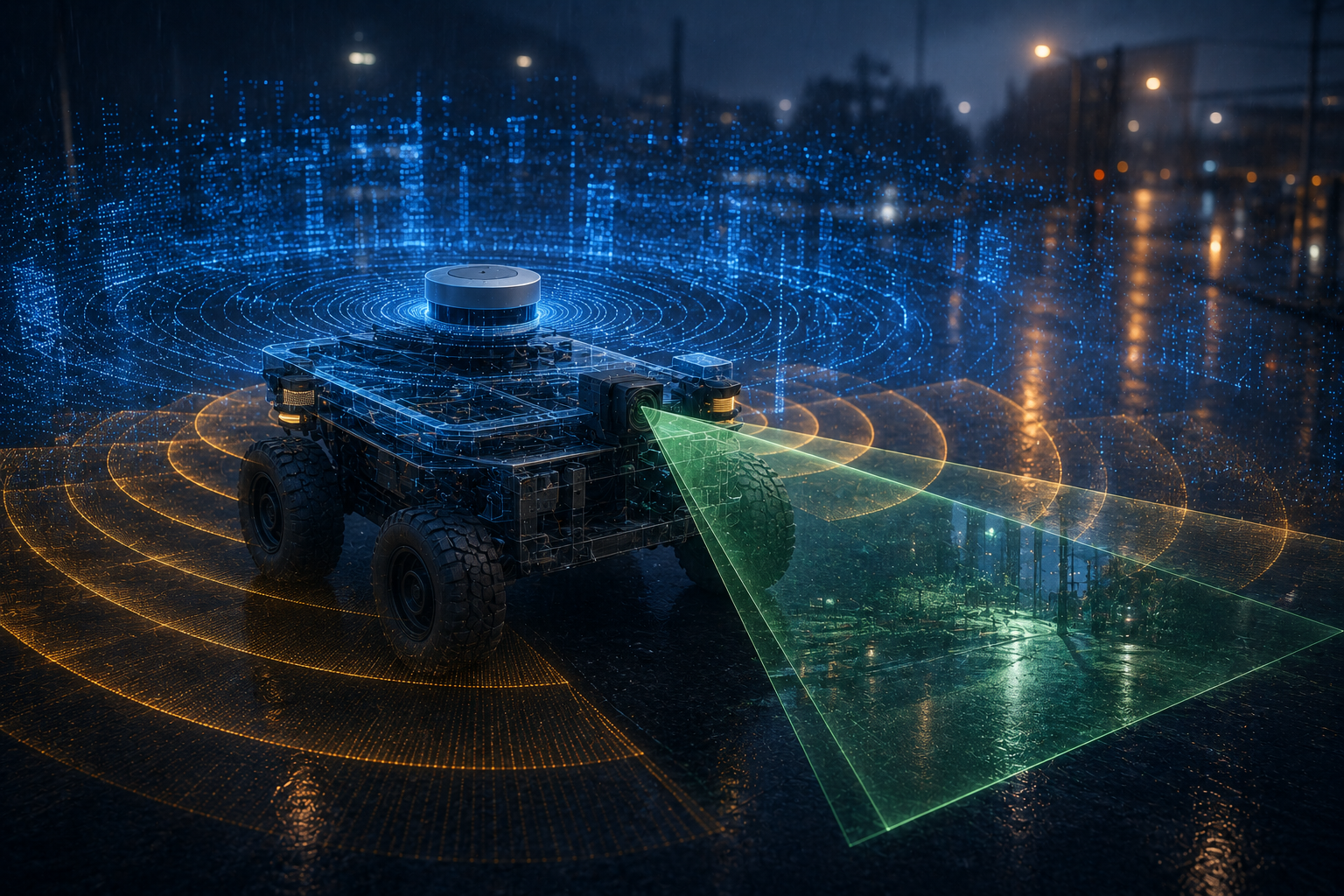
Raw LiDAR point clouds and camera frames are time-synchronized and projected into a shared coordinate frame, producing a fused occupancy grid. Radar returns are processed in parallel and merged in as a velocity and all-weather confidence layer, with the fused output feeding the planning and control stack downstream.
Matching Sensors to the Mission Profile
The right sensor mix depends heavily on the operating environment and the cost tolerance of the platform. An indoor warehouse AMR moving at walking pace in a controlled, well-lit facility can often get away with a leaner stack: a couple of low-cost LiDAR units for mapping and obstacle avoidance, plus cameras for barcode and shelf recognition, with little need for radar since weather is not a factor. A last-mile sidewalk delivery robot operating outdoors in variable weather needs a more balanced mix, since it will encounter rain, glare, and low light on a routine basis. A highway-speed or agricultural platform operating at long range and higher velocity leans harder on radar for early warning and velocity data, with LiDAR and camera handling closer-range precision.
| Platform type | Primary sensor | Supporting sensors | Rationale |
|---|---|---|---|
| Indoor warehouse AMR | LiDAR | Camera | Controlled lighting, precise geometry needed for tight aisles |
| Outdoor sidewalk delivery robot | Camera + LiDAR fusion | Radar, ultrasonic | Variable weather and lighting, mixed pedestrian traffic |
| Agricultural or field robot | Radar | Camera, LiDAR | Dust, long unobstructed sightlines, variable weather |
| Inspection drone | Camera | LiDAR (for 3D asset mapping) | Weight budget favors lighter, cheaper sensors |
Compute and Power Budgets Shape the Decision Too
Sensor selection is never purely about the sensor itself; it is also about what the sensor demands downstream. LiDAR point clouds are large and require dedicated processing to filter, cluster, and register in real time, which adds GPU or dedicated accelerator cost to the bill of materials. High-resolution cameras running deep neural networks for detection and segmentation are similarly compute-hungry, especially if the platform runs multiple cameras for surround coverage. Radar, by contrast, is comparatively light on the compute budget, since its output is already a sparse set of range-velocity-angle measurements rather than a dense point cloud or image.
Power draw follows a similar pattern. A platform with a tight power budget, such as a small aerial drone, will often favor cameras and lightweight radar over power-hungry LiDAR. A ground robot with a larger battery and more generous thermal envelope has more freedom to add LiDAR units without compromising runtime.
Where the Sensor Market Is Heading
The cost and performance curves for all three sensor families keep moving, and the gap between them keeps narrowing in some respects while widening in others. Solid-state LiDAR has already cut manufacturing complexity by removing the spinning mechanical assembly that dominated first-generation units, and that trend is expected to continue pushing unit prices down as production volume increases. At the same time, a new generation of four-dimensional imaging radar is closing part of the resolution gap that used to separate radar from LiDAR, adding elevation measurement on top of range, azimuth, and velocity, which gives radar a much richer point cloud than older two-dimensional designs produced.
Camera-based perception continues to benefit the most from advances in machine learning rather than from changes in the sensor hardware itself. Monocular depth estimation, multi-camera surround stitching, and transformer-based perception backbones have made pure camera stacks meaningfully more capable at inferring distance and classifying edge cases than they were even a few years ago, though they still cannot fully substitute for an active-ranging sensor in safety-critical scenarios. The practical implication for a systems engineer is that a sensor decision made today should assume the cost and capability gaps will keep shifting, and the physical mounting, wiring harness, and compute architecture should leave room to swap or add a sensor generation later without a full platform redesign.
Procurement teams are also increasingly weighing total lifecycle cost rather than sticker price alone. A cheaper sensor that requires more frequent recalibration, a shorter service life in outdoor conditions, or a heavier compute load to process its output can end up costing more over a multi-year fleet deployment than a pricier sensor that is easier to maintain and calibrate. Building that lifecycle view into the initial sensor selection process, rather than treating it as a hardware afterthought, is one of the more reliable ways to avoid a costly mid-program pivot.
Common mistake
Teams frequently choose a sensor suite based on what worked in a demo environment — usually a dry, well-lit test facility — and then discover in the field that the missing modality was the one covering the failure case they never tested. A camera-only stack that performs beautifully indoors can fail hard the first time it meets direct sun glare or heavy rain, precisely because those conditions were never part of the validation loop.
What worked
Programs that succeeded generally built a failure-mode matrix early: for each sensor, they listed the specific conditions (rain, glare, dust, darkness, close-range clutter) under which it degrades, then deliberately chose a second sensor whose failure modes did not overlap. That structured approach caught weak points before expensive field trials, rather than after.
Frequently Overlooked Considerations
- Sensor synchronizationFusing data from sensors with different frame rates and latencies requires precise timestamping; a few milliseconds of drift can misalign a fast-moving object across modalities.
- Calibration driftVibration, temperature swings, and mechanical wear can shift extrinsic calibration between sensors over months of operation, silently degrading fusion accuracy.
- Field-of-view gapsOverlapping sensor placement is needed at panel seams and blind corners; a single missing degree of coverage at the wrong height is where accidents concentrate.
- Contamination and cleaningDust, mud, and lens fogging degrade optical sensors first; outdoor platforms need cleaning cycles or self-heating lens covers built into the maintenance plan.
- Data labeling costCamera-heavy stacks require far larger annotated datasets than LiDAR-heavy stacks, which shifts cost from hardware into ongoing data operations.
- Redundancy versus cost creepAdding a third sensor for safety margin also adds a third failure mode to monitor and a third calibration routine to maintain, and this trade-off is easy to underestimate.
Glossary
- Sensor fusion
- The process of combining data from multiple sensor types into a single, more reliable representation of the environment than any sensor could produce alone.
- Point cloud
- A set of 3D coordinate points produced by LiDAR or depth cameras, representing the surfaces of objects in a scene.
- Doppler effect
- The shift in frequency of a reflected wave caused by relative motion between the sensor and the object, used by radar to directly measure velocity.
- Occupancy grid
- A map representation that divides the environment into cells and estimates the probability that each cell is occupied by an obstacle.
- Solid-state LiDAR
- A LiDAR design that uses no large spinning mechanical parts, instead steering the laser beam electronically, reducing cost, size, and failure points.
Key Takeaways
- LiDAR offers the most precise geometry but costs more and degrades in fog, rain, and dust.
- Radar is the most weather-resistant and cost-effective option for long-range detection and velocity measurement, at the expense of angular resolution.
- Cameras deliver the richest semantic detail at the lowest hardware cost, but depend entirely on lighting conditions and lack native depth.
- Sensor fusion, not a single “best” sensor, is what production autonomy stacks rely on to cover each modality’s blind spots.
- The right sensor mix depends on the mission profile: indoor AMRs, outdoor delivery robots, and field robots each favor a different balance.
- Compute and power budgets are just as important as the sensor’s raw specifications when deciding what a platform can actually carry.
- Validation programs should deliberately test each sensor’s known failure conditions rather than relying on results from a single controlled demo environment.
FAQs
Is LiDAR always better than radar for autonomous robots?
No. LiDAR gives more precise geometric detail, but radar is far more robust in rain, fog, dust, and darkness, and it measures velocity directly. The better choice depends on the operating environment and whether weather resistance or geometric precision matters more for the mission.
Can a robot navigate safely using only cameras?
Camera-only navigation is possible and common in cost-sensitive platforms, but it depends heavily on lighting conditions and struggles with glare, darkness, and low-texture surfaces. Most safety-critical deployments pair cameras with at least one other sensor type for redundancy.
Why is sensor fusion considered necessary rather than optional?
Because LiDAR, radar, and cameras each fail under different conditions, fusion allows one sensor’s weakness to be covered by another’s strength. A fused system is measurably more robust across weather, lighting, and clutter conditions than any single sensor operating alone.
How much does a robotics-grade LiDAR unit cost in 2026?
Solid-state and MEMS-based robotics-grade LiDAR units commonly range from around $500 to $1,000 or more, depending on range and resolution, a substantial drop from the tens of thousands of dollars that early spinning automotive-grade units cost.
What is the difference between early fusion and late fusion?
Early fusion combines raw or lightly processed sensor data before detection decisions are made, preserving more information but requiring tighter synchronization. Late fusion runs independent detection pipelines per sensor and merges the resulting object lists, which is simpler but can miss subtle cross-sensor cues.
Why do radar sensors struggle with angular resolution?
Radar operates using radio wavelengths, which are far longer than the wavelengths of visible or near-infrared light used by cameras and LiDAR. Longer wavelengths inherently produce coarser spatial resolution, making it harder to distinguish closely spaced objects.
Does adding more sensors always improve safety?
Not automatically. Each additional sensor introduces its own calibration, synchronization, and maintenance requirements, and poorly integrated redundancy can add complexity without improving real-world reliability. The goal is complementary coverage of failure modes, not simply more sensors.
How does weight and power budget affect sensor choice on drones?
Aerial platforms have strict weight and power limits, which typically pushes designers toward lightweight cameras and compact radar rather than heavier, more power-hungry LiDAR units, unless precise 3D mapping is a core mission requirement.
References
- Oliver Wyman, “LiDAR v Radar: The Future Of Autonomous Driving Systems”
- Unidata.pro, “Lidar vs Radar: Complete Guide 2026”
- ResearchGate, “Comparative Analysis of LiDAR, Radar, and Camera Sensors for Autonomous Perception: Principles, Challenges, and Fusion Strategies”
- arXiv, “On depth prediction for autonomous driving using self-supervised learning”
For teams building out the broader autonomy stack, this sensor trade-off analysis pairs well with a deeper look at how sensor fusion feeds into SLAM and semantic mapping in the full perception pipeline. Middleware and deployment questions are covered in our guide to ROS 2 in production environments, while fleets that update sensor firmware in the field should review over-the-air update practices that do not break safety cases. Sensor selection also has downstream implications for liability and insurance planning for autonomous machines, and for how a platform is positioned against the broader robotics standards landscape. Teams weighing safety-rated sensor architectures should also see our explainer on functional safety standards for robots.