| Method | Typical Daily Planting Capacity | Crew Needed | Best Terrain Fit |
|---|---|---|---|
| Manual ground planting crew | Hundreds to low thousands of seedlings per crew | Large hand-planting teams | Accessible, gently sloped land |
| Single reforestation drone | Several thousand seed pods | One trained operator | Small to mid-size sites |
| Coordinated drone swarm | Up to roughly 250,000 seed pods across a fleet | One or two supervisors for the whole swarm | Steep, fire-scarred, or flood-damaged terrain no crew can safely enter |
From Labor-Heavy Replanting to Coordinated Aerial Swarms
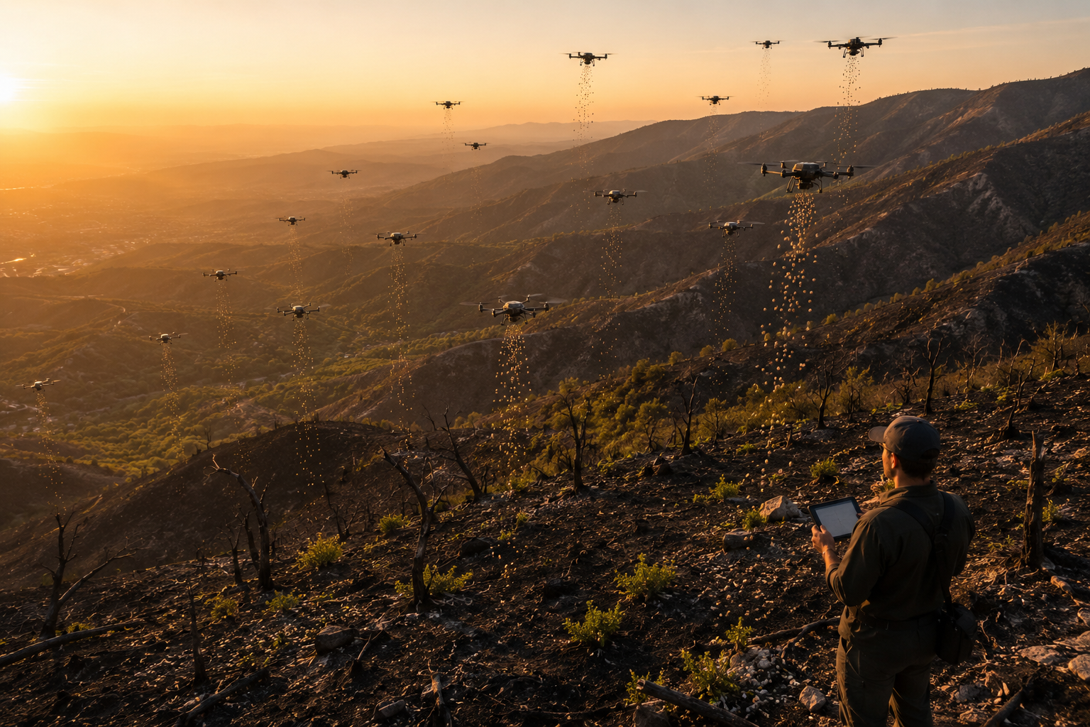
Reforestation has traditionally been one of the most labor-intensive parts of land restoration. Getting seedlings or seeds into the ground across thousands of hectares of steep, fire-damaged, or flood-scarred terrain has historically required large hand-planting crews working in difficult and sometimes hazardous conditions, often over many weeks per site. Swarm robotics is changing that math directly: rather than one drone flying one pattern, multiple autonomous aircraft now work the same site simultaneously, coordinated by a shared flight plan and supervised by just one or two human operators on the ground.
This shift from single-drone demonstrations to genuine multi-drone swarm operations is what separates the current generation of reforestation technology from the seed-dispersal drone concepts that circulated years earlier. Swarm planting is moving from research pilots into early commercial use, with operators now able to coordinate several aircraft under unified supervision to plant tens of thousands of seeds in a single day across a large area, reaching terrain no human crew could safely or efficiently access.
| Technology Stage | What It Does | Why It Matters |
|---|---|---|
| Pre-planting site mapping | Drones survey terrain, soil, and existing vegetation to identify optimal planting locations | Improves germination odds by matching seed placement to microsite conditions |
| Aerial seed pod dispersal | Swarm of drones drops biodegradable seed pods across the mapped site | Covers large or inaccessible areas far faster than ground crews |
| GPS-logged pod placement | Each pod’s drop coordinates are recorded during dispersal | Allows precise, targeted post-planting monitoring and revisit |
| Post-planting monitoring | Follow-up drone flights track germination and seedling survival over time | Confirms restoration success and guides any re-seeding needed |
How a Reforestation Drone Swarm Actually Operates
A modern reforestation mission typically starts well before any seed pod leaves a drone. Mapping flights survey the target site to assess terrain slope, existing vegetation cover, and soil conditions, generating a planting plan that identifies the specific microsites most likely to support germination rather than scattering seed pods uniformly across the whole area. This targeting step matters enormously for success rates, since a seed pod dropped on compacted, sun-baked soil behaves very differently from one dropped in a shaded, moisture-retaining hollow just a few meters away.
Once the planting plan is set, the actual dispersal phase is where swarm coordination shows its advantage most clearly. Multiple drones fly the site simultaneously under a shared operational plan, each covering its own assigned sector, which lets a single field team plant an area in hours that would otherwise take a ground crew days or weeks to cover on foot. One widely cited operator has demonstrated autonomous drones capable of dropping up to roughly 250,000 seed pods in a single day, while other companies favor smaller, tighter swarms, typically around five drones working together, reseeding on the order of 25 to 50 acres of fire-ravaged terrain daily.
The seed pods themselves are purpose-engineered for this delivery method. Biodegradable capsules carry the seed itself along with nutrients and a protective coating that breaks down completely in the soil over time, leaving no plastic or synthetic residue behind. Some systems log the exact GPS coordinates of every pod dropped, which turns the planting operation into a dataset rather than a one-time event, letting restoration teams revisit specific coordinates later to check germination or target follow-up seeding precisely where it is needed.
The Swarm Reforestation Workflow
A mapping drone first surveys the site and flags optimal microsite locations based on terrain and soil data; a coordinated swarm of planting drones then flies assigned sectors simultaneously, dispersing GPS-logged biodegradable seed pods; weeks or months later, monitoring drones revisit the same logged coordinates to measure germination and guide any targeted re-seeding.
Where Swarm Reforestation Is Already Working
The clearest real-world case studies come from fire-damaged and flood-scarred landscapes where ground crews face genuine access and safety problems. Operators have used autonomous drone swarms to restore koala habitat in New South Wales, regenerate flood-damaged forest areas around Lismore, and replant fire-cleared landscapes across remote parts of Australia, terrain that in many cases would be too steep, too remote, or too hazardous for a conventional planting crew to work safely soon after a disaster. According to industry reporting, these autonomous missions can complete planting work at roughly 25 times the speed of a conventional ground crew while cutting costs by around 80 percent compared to traditional hand-planting methods.
Other operators have focused specifically on the wildfire-recovery niche, using rapid-fire drone dispersal to replant thousands of trees per day across recently burned landscapes, capitalizing on the narrow window after a fire when soil conditions are still favorable for germination but before erosion sets in. Still others have built their business model around turning reforestation into a financial asset, verifying planted areas and the resulting carbon sequestration so landowners or investors can generate and sell carbon credits tied to the restored acreage, deploying a swarm of several drones to reseed 25 to 50 acres per day on fire-ravaged terrain as part of that verified process.
| Use Case | Terrain Challenge | Swarm Advantage |
|---|---|---|
| Post-wildfire replanting | Steep, ash-covered slopes prone to erosion | Rapid coverage within the narrow post-fire germination window |
| Flood-damaged forest recovery | Waterlogged, unstable, or debris-strewn ground | Aerial access without heavy machinery compacting wet soil |
| Habitat restoration for wildlife | Remote areas with limited road access | Precise targeting of species-appropriate microsites |
| Carbon credit reforestation projects | Large acreage requiring verifiable planting records | GPS-logged pod data supports auditable carbon accounting |
Common mistake
Assuming aerial seed dispersal alone equals successful reforestation. Simply dropping seed pods from the air without proper site mapping, appropriate seed-to-microsite matching, and follow-up germination monitoring can produce disappointing survival rates. The operators seeing the strongest results treat dispersal as the middle step of a three-part workflow, not a standalone solution, and pair it with dedicated pre-planting mapping and post-planting monitoring flights.
What worked
Running field trials that validated the full pipeline together rather than testing seed dispersal in isolation. Spring 2026 field trials tested drone systems end to end, covering operational capability, the accuracy of remote sensing in targeting suitable planting sites, and the germination performance of different seed capsule designs, giving operators integrated data instead of results from disconnected experiments.
Remaining Constraints on Swarm Reforestation
Despite the rapid progress, swarm reforestation is not yet a universal replacement for traditional planting. Germination rates for aerially dispersed seed pods still vary significantly by species, soil type, and site conditions, and remain generally lower per-seed than a hand-planted seedling with an established root ball, which is part of why operators compensate with sheer volume and precise microsite targeting rather than relying on any single pod’s success. Battery endurance and payload capacity also cap how large a single flight sector can be before a drone must return to reload, which is precisely why coordinated multi-drone swarms rather than single larger aircraft have become the preferred scaling strategy.
Regulatory airspace rules for coordinated multi-drone flights are also still maturing in many jurisdictions, particularly for beyond-visual-line-of-sight operations over large restoration sites, an area that mirrors similar airspace integration challenges seen in other autonomous aerial applications such as wildfire response drones.
- Microsite targetingMatching a specific seed drop location to favorable local soil, shade, and moisture conditions rather than dispersing pods uniformly across an entire site.
- Biodegradable seed podA capsule containing a seed, nutrients, and a protective coating engineered to break down completely in soil, leaving no synthetic residue behind.
- Beyond visual line of sight (BVLOS)Drone operations conducted outside the pilot’s direct line of sight, a regulatory category still being clarified in many regions for large-scale coordinated swarm flights.
- Germination performanceThe rate at which dispersed seeds successfully sprout and establish, a key metric operators track through post-planting monitoring flights.
- Carbon credit verificationThe process of documenting planted acreage and resulting carbon sequestration with enough precision to support the sale of verifiable carbon credits, increasingly reliant on GPS-logged drone planting data.
Glossary
- Swarm planting
- The coordinated use of multiple drones flying simultaneously under one or two supervisors to disperse seed pods across a large restoration site.
- Seed pod dispersal
- The process of releasing biodegradable capsules containing seeds and nutrients from a drone onto a targeted planting site.
- Pre-planting site mapping
- Drone-based surveying of terrain, soil, and vegetation conducted before seeding to identify the most favorable planting locations.
- Post-planting monitoring
- Follow-up drone flights that track germination and seedling survival over weeks or months after initial dispersal.
- Fire-scarred terrain
- Land recently burned by wildfire, often steep, ash-covered, and erosion-prone, representing one of the primary target environments for reforestation drone swarms.
Key Takeaways
- Swarm robotics coordinates multiple drones under one or two supervisors to plant tens of thousands of seed pods a day across large or inaccessible sites.
- Leading operators have demonstrated autonomous swarms dropping up to roughly 250,000 seed pods daily on fire-damaged and flood-scarred Australian landscapes.
- Smaller, tightly coordinated swarms of around five drones can reseed 25 to 50 acres of fire-ravaged terrain per day for other operators.
- The full workflow spans three stages: pre-planting site mapping, GPS-logged seed pod dispersal, and post-planting germination monitoring.
- Biodegradable seed pods carry seeds, nutrients, and a protective coating that breaks down completely in soil, leaving no synthetic waste.
- Aerial dispersal alone does not guarantee reforestation success; germination rates remain variable and depend heavily on accurate microsite targeting.
- Some operators tie GPS-logged planting data directly to carbon credit verification, turning reforestation into an auditable financial asset.
FAQs
How many seed pods can a reforestation drone swarm plant in a day?
Capacity varies by operator: some autonomous swarms can drop up to roughly 250,000 seed pods per day across a large site, while other operators run smaller five-drone swarms that reseed about 25 to 50 acres of fire-damaged terrain daily.
What is inside a biodegradable seed pod?
A typical pod contains the seed itself, nutrients to support early growth, and a protective coating that breaks down completely in the soil over time, leaving no plastic or synthetic residue in the ground.
Does swarm planting work better than traditional hand planting?
Swarm planting is dramatically faster and cheaper, reportedly around 25 times faster and up to 80 percent less costly than conventional crews in some reported cases, but per-seed germination rates can still trail a carefully hand-planted seedling, so scale and precise targeting are used to compensate.
How do drones know where to drop seeds for the best results?
Pre-planting mapping flights survey terrain slope, soil conditions, and existing vegetation to build a planting plan that targets favorable microsites, rather than dispersing seed pods uniformly across the entire area.
What kinds of terrain benefit most from reforestation drone swarms?
Steep, fire-scarred hillsides, flood-damaged or waterlogged forest areas, and remote sites with limited road access benefit most, since these conditions make traditional ground-crew planting slow, unsafe, or impossible.
How do operators know if the planted seeds actually germinated?
Post-planting monitoring flights revisit the GPS-logged coordinates of each dropped seed pod over subsequent weeks or months to track germination and seedling survival, allowing targeted re-seeding where needed.
Are there regulatory hurdles to running multi-drone reforestation swarms?
Yes. Rules around beyond-visual-line-of-sight operation for coordinated multi-drone flights are still maturing in many jurisdictions, particularly for large restoration sites where a swarm needs to operate outside a single pilot’s direct line of sight.
Can reforestation drone data support carbon credit programs?
Yes. GPS-logged planting records showing exactly where and when seed pods were dispersed provide an auditable data trail that some reforestation companies use to verify planted acreage and support the sale of carbon credits.
For related robotics coverage, see how robotics in agriculture handles automated planting and harvesting and how autonomous weeding and precision spraying systems apply similar precision-targeting principles on farms. Readers may also want to review agricultural robotics ROI for mid-size farms for a cost-benefit perspective on adopting this kind of technology. Two related deep dives from this same robotics cluster cover wildfire detection and response robotics and deep-sea mining robotics.
- PlanetTools, “Is Drone Tree Planting in 2026 Really Changing Reforestation?”
- The Next Web, “Seed-firing drones declare war on deforestation”
- Mongabay, “New Tree Tech: AI, drones, satellites and sensors give reforestation a boost”
- Advexure, “Reforestation by Air: How Seed-Planting Drones Are Restoring Forests”
- Copture, “Drone seeding for reforestation: a high-tech solution with growing impact”
- PlanetTools, “8 Drone Planting Systems That Slash Costs by 70% (2026 Guide)”
- FPInnovations, “Forest Seeding by Drone: FPInnovations Paves the Way for a New Approach to Reforestation”
- Techstars, “DroneSeed: Scalable Reforestation Using Drones”
- theflyingengineer.com, “DroneSeed: Innovative Drone Solutions For Reforestation Projects”